
|
|
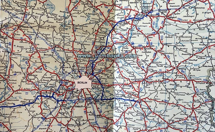
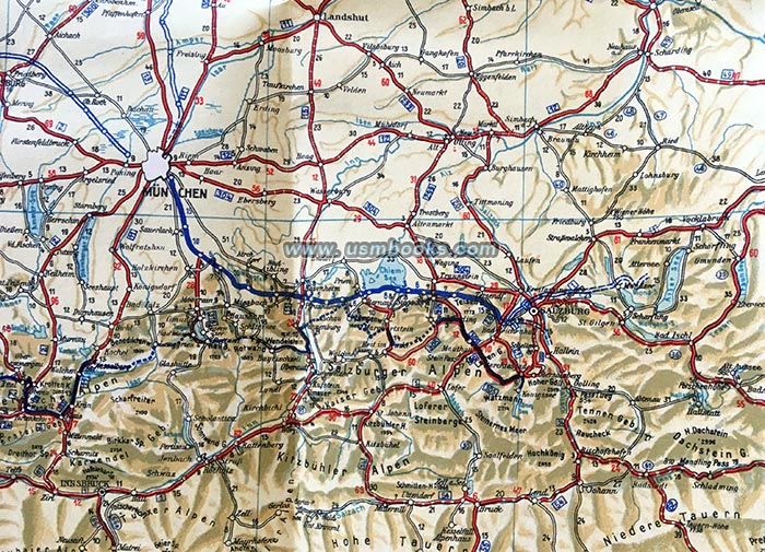
This is a historic 85 year old color road map of Nazi Germany showing the enormous progress made in the road network of the country during the first five years of National Socialist rule. The Reichsautobahn between the industrial Ruhrbegiet in the west to Reichshauptstadt Berlin was nearly finished, and the many stretches of Hitler's freeways under construction were clearly marked on this map.
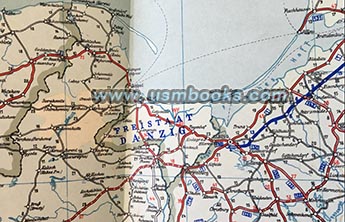
It was printed after the Anschluß when Austria was already part of Greater Germany, but before the 1939 invasion of Poland. Danzig is still shown as a separate entity (Freistaat Danzig) and Czechoslovakia was also not part of Nazi Germany yet. The map covers a huge area: Königsberg in the northeast, Budapest in the southeast, northern Italy, Switzerland, eastern France, Luxembourg and Belgium, we well as a fairly large part of Holland in the west.
Printed by Jro-Verlag München Carl Kremling München, it looks like the DDAC member who owned this DDAC Strassenzustandskarte von Deutschland just put it away and never used it. It is in excellent like-new condition, no tears, no tape, no fading, no odor.
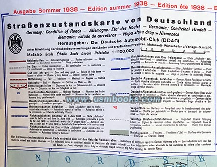
Germany was a popular tourist attraction in 1938, and this map was clearly printed with visitors in mind. Aside from German, the text on the map is printed in five other languages (English, French, Italian, Spanish and Polish).
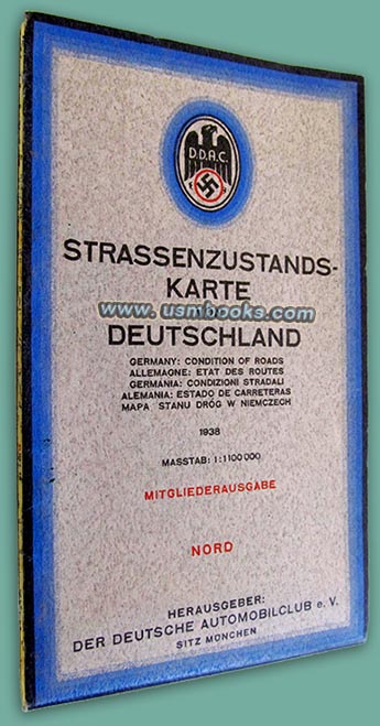
This full-color Nazi map was printed for members of the DDAC (Der Deutsche Automobilclub), the German Auto Club. Folded out, it measures 34-½ x 41 inches and is very detailed (scale 1:000,000).
This full-color Nazi map was printed for members of the DDAC (Der Deutsche Automobilclub), the German Auto Club. Folded out, it measures 34-½ x 41 inches and is very detailed (scale 1:000,000).
Have a look at the 1939 edition of this DDAC map, as well as
many
other original Third Reich maps for sale on USMBOOKS.com.
We are happy to combine shipping to save you money!
for $95.00 delivered by 1st Class Mail in the continental USA. |
| • IF you prefer faster and safer Priority Mail shipping with USPS Tracking add $8.95. |
| • IF you wish to purchase highly recommended, but optional insurance, add $3.50. |
| • We will be happy to ship abroad at additional cost, however foreign customers are responsible for any VAT payments, import duties & customs clearing fees. Please inquire. |
1938 COLOR MAP OF THE EXPANDING ROAD NETWORK OF NAZI GERMANY
ORIGINAL THIRD
REICH COLOR DDAC STRASSENZUSTANDSKARTE VON DEUTSCHLAND 1938 UNUSED CONDITION
