
|
|


This is a very nice First Edition of Großdeutschland in Bild und Karte (Greater Germany in Pictures and Maps), a fine 7 x 10 inch, 206 page hardcover Nazi book with 194 photos and 111 maps, published in 1939 by F.A. Brockhaus in Leipzig.
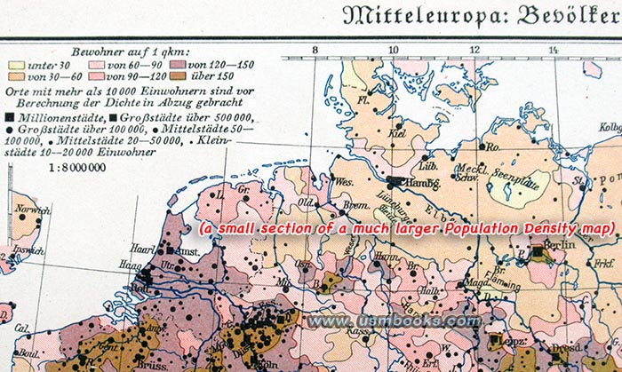
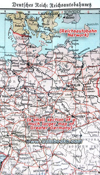
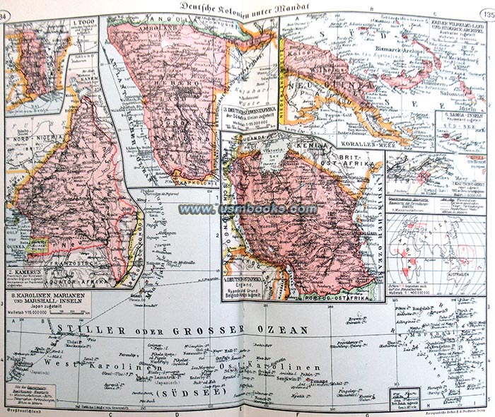
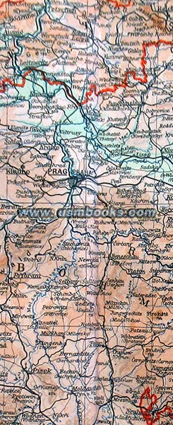
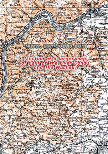
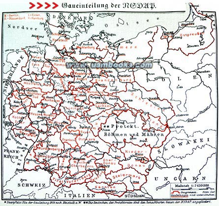
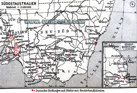
This nice quality, in-depth Nazi reference book starts with statistics about size (the Alps, the Elbe and Rhine rivers, lakes, islands), climate, population by German area (including colonies in Africa and the Pacific Ocean), etc. This statistical information is then shown on colorful, highly detailed maps. Additional maps (some with fold-out panels) show Nazi Party Gaue or districts, the Reichsautobahn (freeway) network, health resorts, different races in Europe (Nordic, Baltic, etc.), portions of the country by forests, industries, dialects spoken in different parts of Greater Germany, etc.
This nice quality, in-depth Nazi reference book starts with statistics about size (the Alps, the Elbe and Rhine rivers, lakes, islands), climate, population by German area (including colonies in Africa and the Pacific Ocean), etc. This statistical information is then shown on colorful, highly detailed maps. Additional maps (some with fold-out panels) show Nazi Party Gaue or districts, the Reichsautobahn (freeway) network, health resorts, different races in Europe (Nordic, Baltic, etc.), portions of the country by forests, industries, dialects spoken in different parts of Greater Germany, etc.

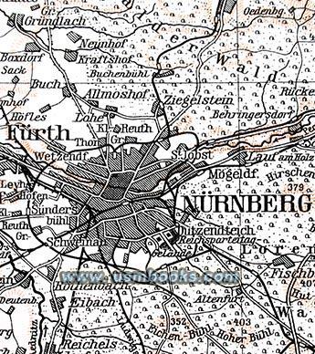


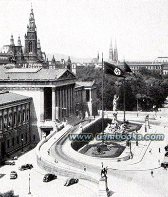
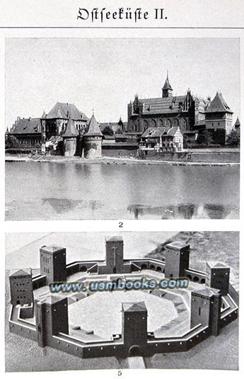
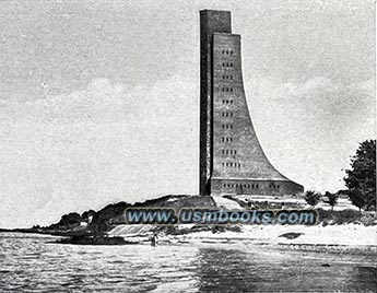
Interspersed in the color maps are glossy pages with 194 black & white photos of well-known sights, architecture, scenery, including Hermann Göring’s new Air Ministry in Berlin, the Marine-Ehrenmal at Kiel-Laboe, Hindenburg’s grave at Tannenberg, Großdeutschland’s second largest city Vienna and its the Parliament building, the harbor of Lindau on the Bodensee, steep vineyards on the Mosel river, historic Prague, German settlements on the Baltic and in Africa, quaint villages in Silesia, historic churches, castles, palaces, half-timbered houses, etc., etc.
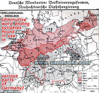
An example of these interesting map/charts is one on the top of page 43 that shows Germany divided into sections where linguistic diminutive word endings such as ken, chen, ing, li, la, lin, lein, are prevalent! Another map/chart shows the entire country divided into a dozen or so areas based on the styles of farm houses. Small wonder, in view of these sorts of cultural and language differences that the Gestapo and police could very easily question and detect persons misrepresenting their origins in Germany. Großdeutschland in Bild und Karte is absolutely essential studying or writing about Hitler’s Nazi Germany.

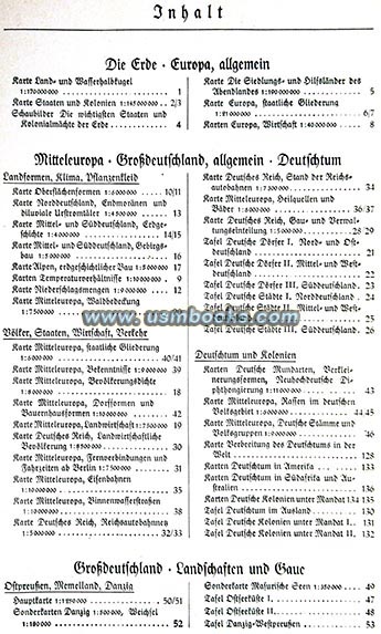
All the photos have captions, and the orange linen hardcover book is fully indexed in 70 pages at the back. While the cover is somewhat faded, this 85 year old book is in very nice used condition. If we were only going to have one Third Reich German atlas, this is the one we'd have!
Have a look at the large selection of original Third
Reich maps
for sale on USMBOOKS.com. We are happy to combine
shipping of multiple purchases!
USM book #1102 |
| • IF you prefer faster and safer Priority Mail shipping with USPS Tracking add $9.00. |
| • IF you wish to purchase highly recommended, but optional insurance, add $3.50. |
| • We will be happy to ship abroad at additional cost, however foreign customers are responsible for any VAT payments, import duties & customs clearing fees. Please inquire. |
HITLER’S GREATER GERMANY IN PICTURES AND MAPS
NAZI HARDCOVER EDITION OF 1939
GROSSDEUTSCHLAND IN BILD UND KARTE FASCINATING STATISTICAL DETAILS ABOUT NAZI GERMANY WITH COLOR MAPS & PHOTOS
