
|
|
RARE 1935 SHELL OIL & GASOLINE COMPANY COLOR MAP OF
|
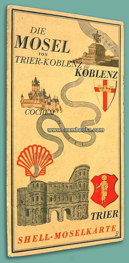
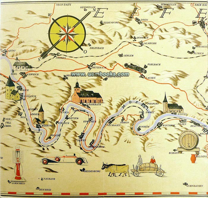
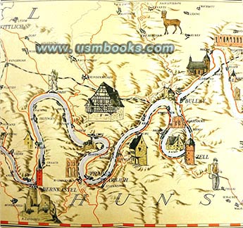
This in a rare original Shell-Moselkarte produced for motorists in 1935. It shows the main highways and small country roads as well as railroads in the area stretching from Trier to Koblenz.
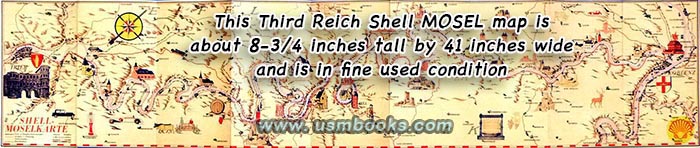
The cover of this Nazi map measures 4-½ x 8-¾ inch, unfolded it is 8-¾ x 41 inches long and the scale is 1:150.00 meaning every centimeter equals four kilometers (about 1-1/2 miles).
The map was designed by famous Professor Werner Peiner. His initials are on the front cover and on the map. Aside from being a well-known German painter, Peiner also designed six tapestries for Adolf Hitler’s new Reichschancellery in Berlin as well as a famous gobelin for the Haus der Flieger in Berlin.
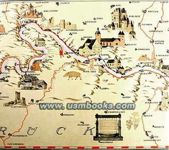
The reverse side of the map has panels with text about noteworthy geographical features, pretty scenery, Roman ruins, medieval castle ruins and other historic and tourist information. The map itself provides an easily followed tour of the German Mosel with lots of detail tucked into the marvelous illustrations.
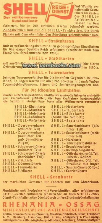
Inside the back flap is advertising for the full range of other city and touring maps produced by Shell Reisedienst.
Inside the back flap is advertising for the full range of other city and touring maps produced by Shell Reisedienst.
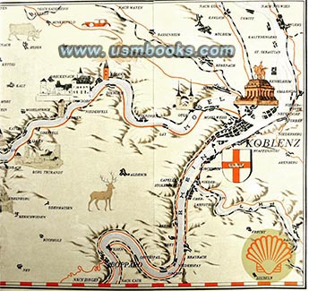
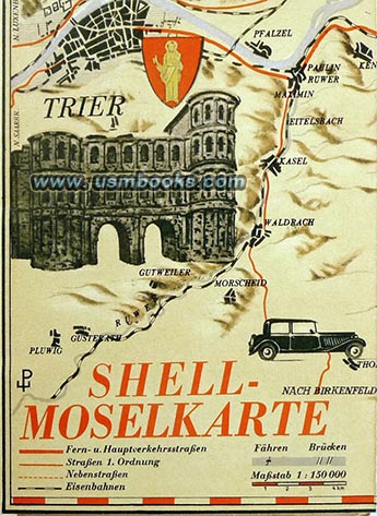
The famous Deutsche Eck monument at the confluence of the Rhine and Mosel river at Koblenz is shown on the right end, the Roman Porta Nigra in Trier (the oldest city in Germany) at the left end. The area in between is Weinland, small historic picturesque towns and villages such as Cochem, Zell, Bernkastel and Piesport, known all over the world for their famous white wines.
intinials of Professor Werner Peiner
who designed this map for Shell
Have a look at other military and civilian Third Reich maps for sale on USMBOOKS.com. We are happy to combine shipping of multiple purchases!
for $65.00 delivered by 1st Class Mail in the USA. |
| • IF you prefer faster and safer Priority Mail shipping with USPS Tracking add $8.95. |
| • IF you wish to purchase highly recommended, but optional insurance, add $3.50. |
| • We will be happy to ship abroad at additional cost, however foreign customers are responsible for any VAT payments, import duties & customs clearing fees. Please inquire. |
This original 1935 Shell-Moselkarte is Shell Oil number ZRK 5524. This 89 year old color map is in nice used (but not abused) condition. No repairs, no tape, no writing, just a very nice rare Nazi era map.
1935 NAZI SHELL MAP SHOWING HISTORIC TOWNS AND CITIES ALONG THE MOSEL RIVER IN GERMAN WINE COUNTRY
