
|
|
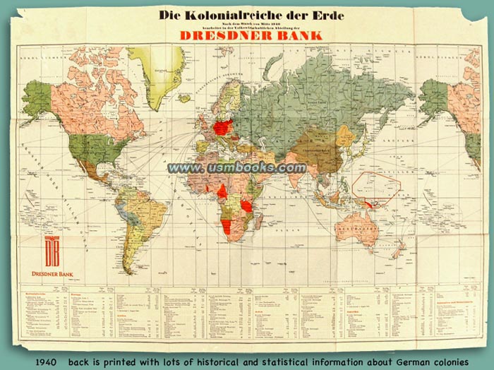
The Political Economics Department of Dresdner Bank put together this very interesting color map called Die Kolonialreiche der Erde (Colonial Empires of the World). They used information available by mid-1940 and it was printed by Georg Stritt & Co. of Frankfurt am Main in December of that same year.
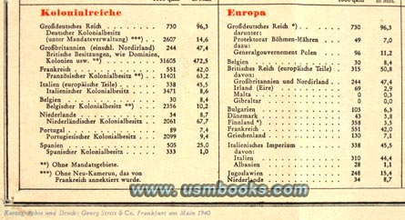
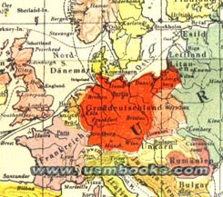
The size and population of colonies ruled by Great Britain, Italy, France, Holland, Spain, Portugal and the Greater German Reich on all continents are shown and listed on this 19 x 27 inch (48 x 55 cm), two-sided map.
The first three panels on the reverse side have historical information about der deutsche Kolonialbesitz (former German colonial possessions on the African continent). It states that at the start of World War I, Germany's colonial empire had 12 million inhabitants on 2.9 million square kilometers and was five times the size of the German motherland.
Other panels on the back side have information about crops, industries and export figures (for diamonds, tobacco, cattle, peanuts, bananas, gold, cotton, for example) from Africa. There is also some information about former German possessions in the Südsee, German New Guinea and the Bismarck Archipelago in the Pacific, for example.
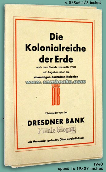
This nearly 80 year old Nazi map was once pinned to a wall and has pin holes in the bottom two corners. Small parts of the two upper corners are missing, other than that, this historical premium from the Dresdner Bank in Glogau in Lower Silesia (now Glogow in southwestern Poland) is in nice used condition.
Have a look at other original - civilian and military - Third Reich maps for sale on USMBOOKS.com. We are happy to combine shipping to save you money!
| • IF you prefer faster and safer Priority Mail shipping with USPS Tracking add $7.75. |
| • IF you wish to purchase highly recommended, but optional insurance, add $3.50. |
| • We will be happy to ship abroad at additional cost. Please inquire. |
1940 NAZI COLOR MAP COLONIAL EMPIRES OF THE WORLD
DECEMBER 1940 NAZI COLONIAL EMPIRE MAP
PUBLISHED BY DRESDNER BANK
