
|
|
RARE 1935 SHELL OIL & GASOLINE COMPANY COLOR MAP OF
|
 |
about the world famous German race track where so many speed records were set on one of the back panels. |
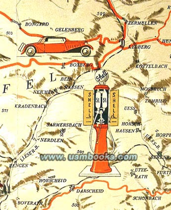
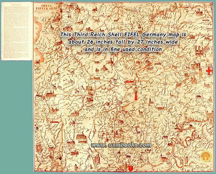
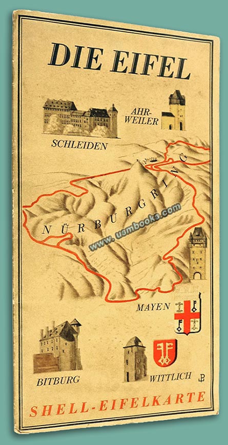
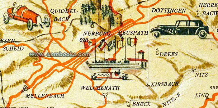
This in a rare original Third Reich Shell-Eifelkarte produced for motorists in 1935. It shows the main highways and small country roads as well as railroads in the ‘Eifel’ area of Germany between the Rhein, Moselle and Ahr rivers including towns such as Bitburg, Schleiden, Wittlich, the world famous Nürburgring automobile race track and even the Adolf Hitler Sprungschanze (ski jump) at Hollerath just east of the German / Belgium border.
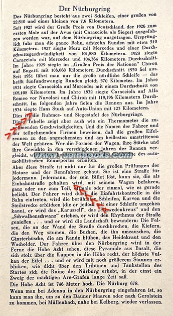
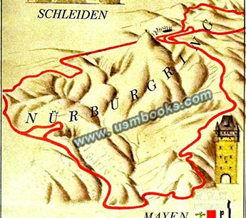
The reverse side text panels have information on the different areas featured on the map side covering noteworthy geographical features, pretty scenery, Roman ruins, medieval castle ruins and other historic and tourist information. One panel is about the world famous Nürburgring race track with its length and features, and the speed records broken by the likes of Rudolf Caracciola, Louis Chiron, Tazio Nuvolari, and Auto-Union driver Hans Stuck who set the track speed record at 123 km per hour during the German Grand Prix on 15 July 1934.
Also prominently mentioned is that “this road was not just built for great engine testing or auto racers”, so every automobile driver could purchase a ticket to drive on the famous race track when there was no race event taking place on the Nürburgring.
Also prominently mentioned is that “this road was not just built for great engine testing or auto racers”, so every automobile driver could purchase a ticket to drive on the famous race track when there was no race event taking place on the Nürburgring.
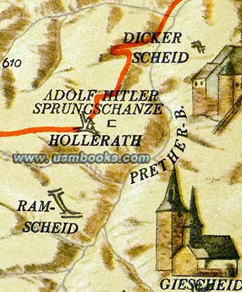 |
Hollerath was inaugurated in 1934 but destroyed at the end of World War II due to its location near the Westwall (Siegfried Line) and heavy fighting in the area during the Battle of the Bulge. |

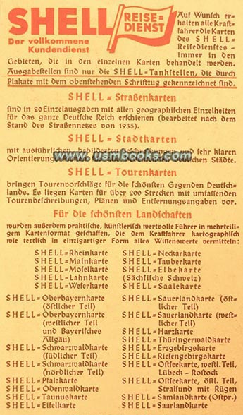
Inside the back flap is advertising for the full range of other city and touring maps produced by Shell Reisedienst all of which are now rare. The edge of the back flap has two punch holes but they do not bother any text or illustrations!
This original 1935 Shell-Eifelkarte is Shell Oil number ZRK 5538. The 88 year old Peiner-designed color map is in nice used (but not at all abused) condition. No repairs, no tape, no writing, just a very nice rare Nazi era map.
This original 1935 Shell-Eifelkarte is Shell Oil number ZRK 5538. The 88 year old Peiner-designed color map is in nice used (but not at all abused) condition. No repairs, no tape, no writing, just a very nice rare Nazi era map.
Folded this Nazi map is 4-½ x 8-¾ inch, and unfolded it measures 26 x 27 inches and the scale is 1:100.000, meaning every centimeter equals one kilometer (0.6 miles). It has text on the back panels by Kasimir Edschmid and the map itself was designed by famous Professor Werner Peiner. Aside from being a very well-known German painter, Peiner also designed six splendid tapestries for Adolf Hitler’s new Reichschancellery in Berlin as well as the famous gobelin for the Haus der Flieger in Berlin.
Have a look at an original Shell map of the Mosel River as well as other military and civilian Third Reich maps for sale on USMBOOKS.com.
We are happy to combine shipping of multiple purchases!
| • IF you prefer faster and safer Priority Mail shipping with USPS Tracking add $8.95. |
| • IF you wish to purchase highly recommended, but optional insurance, add $3.50. |
| • We will be happy to ship abroad at additional cost, however foreign customers are responsible for any VAT payments, import duties & customs clearing fees. Please inquire. |
1935 NAZI
SHELL EIFEL MAP
FEATURING THE ADOLF HITLER
SKI JUMP AND
WORLD FAMOUS NÜRBURGRING
RACE TRACK
